In recent decades, the vulnerability of mountainous regions to extreme events has become evident, due to the impacts of phenomena like glacier melt, storms, and droughts, whose frequency and intensity have risen. At the Institute for Earth Observation, we monitor the environmental dynamics of the Earth’s surface in the mountains aiming to understand changes, investigate their causes, and support the involved communities.
1 - 8
10.05.2024: our Institute during the yearly Klausur event, a day-long meeting where we discussed about our research's direction and future topics.Credit: Eurac Research | Andrea De Giovanni
This image is view from the atmosphere of the city of Bolzano (Italy), created with a composition of data from two Copernicus satellite missions. The left part is a so-called "false color composite", using Sentinel-2 band 8 (near infrared), band 4 (red) and band 3 (green) for the EGB image channels. It is most commonly used to assess plant density and health. The central part is a color composition based on Sentinel-1 radar back-scatter of the two available polarizations, VV and VH. The right part is the classical RGB composite, using Sentinel-2 band 4 (red), band 3 (green) and band 2 (blue) for the RGB image channels. It resembles what our vision sees naturally and what we would see in a standard photo.Credit: Claus | Michele | All rights reserved
Average snow cover 2000-2019 (satellite data)Credit: Eurac Research
Interferometric coherence evolution considering consecutive interferometric pairs of 6, 12 and 18 days. Sentinel-1 A/B data over Doñana (Spain)Credit: Eurac Research
Our researcher is collecting leaf area index (LAI) and forage yield data.Credit: Eurac Research | Laura Stendardi
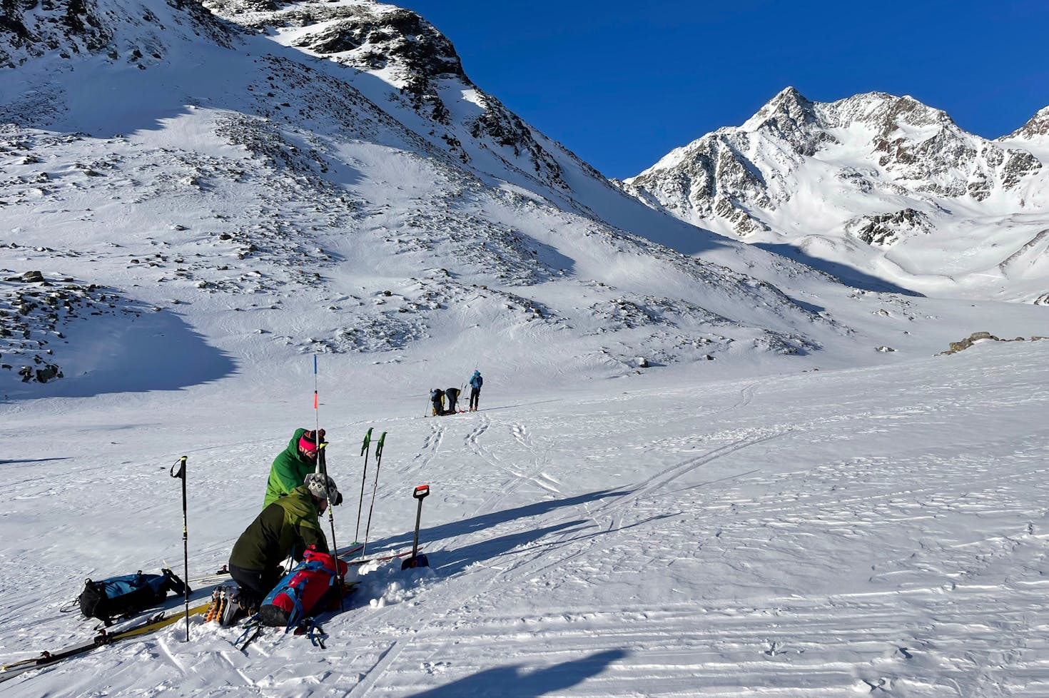
Measurements on the ground were made by eight groups, matching the route of the Cessna aircraft. The measurements were taken at intervals of a few meters. The temperature at altitude was around -15 °C with, at times, very strong wind.Credit: Eurac Research | Maurizio Gretter