magazine_ Article
A breath of snow
New satellite technology to monitor the thermal conductivity of snow
In the past few days, a small Cessna aircraft carrying an experimental technology flew over the Senales Valley in South Tyrol between Vernago Lake and Grawand. Over the course of two flights, a sensor measured the heat exchange between snow and air. On the ground, along the same routes, eight teams led by Eurac Research experts measured snow depth with scaled rods and weighed the snow to determine its type. If analysis of the data collected proves the technology is reliable and the measurements match those taken on the ground, it could go on to be mounted on satellites.
For weeks, emails among researchers had been going back and forth: “There is a possible window next week,” “Canceled: bad weather on the way,” “We’ll try again as soon as high pressure returns.” Then, finally, the announcement: “We’ve got the go ahead for tomorrow.” The emails take on a new tone. Checklists for equipment, updated checklists for equipment, flight plans, safety arrangements for the umpteenth time.
At first light on April 4th, the first group sets off loaded with skis, ski skins and backpacks.


Soon after, a small Cessna aircraft takes off from Trento's airport. On board, technology to be tested.
The first flight arrived in the valley around 7 a.m., the second around 1 p.m. During each flight the Cessna zigzagged over the area at an altitude of 5,000 meters for about 40 minutes. From the ground, only a speck of the plane is visible and you can hardly hear the roar of the engine because of the strong wind.
Two flights at different times of the day
For the research team, having the same flight at different times of the day was critical. “Until now, to monitor snow we have used satellite images that measure direct properties such as depth and density,” explains Carlo Marin, a remote sensing engineer at Eurac Research. “Instead, this technology developed by University Milano Bicocca measures how the snow breathes, that is, the heat exchange between the snow and the air. From this information we can gauge properties such as density and type of snow. In the early morning flight, the temperature is cooler, and in the warmer hours of the day, the surface layer of snow is warmer due to higher temperatures and sunlight. The difference in temperature relates to how different types of snow exchange heat with their surroundings. In addition, the experimental sensor images promise very high resolution.”
“This technology measures how the snow breathes, that is, the heat exchange between the snow and the air. From this information we can gauge properties such as density and type of snow.”
Carlo Marin
As the small Cessna plane flew along 12 strips technically known as “transects”, 22 people were in place on the ground to measure the depth of the snow and its weight at three-meter intervals. And by doing so, were able to determine the snow density.

Some research teams were not far from lifts, but others had to reach remote spots, such as the Teufelsegg peak, in below the Weisskugel (3,738 m), by trekking for hours with skis, ski skins and backpacks loaded with equipment. One team was also accompanied by technicians carrying the same type of sensor as the one mounted on the plane to further corroborate the measurements from the ground.
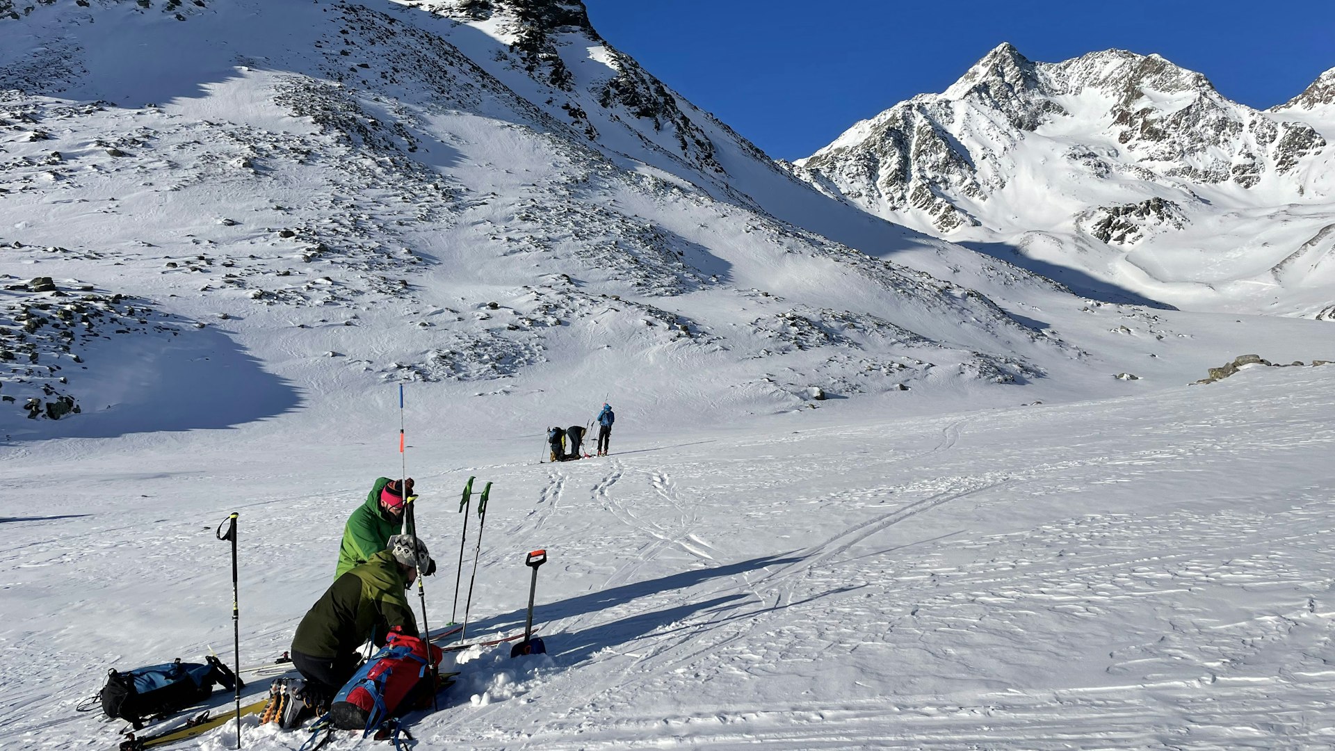 Photo: Maurizio Gretter | Eurac Research
Measurements on the ground were made by eight groups, matching the route of the Cessna aircraft. The measurements were taken at intervals of a few meters. The temperature at altitude was around -15 °C with, at times, very strong wind.
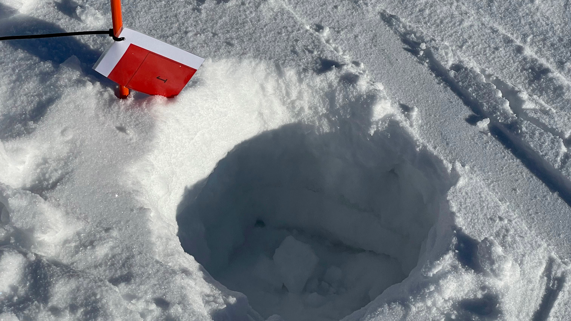 Photo: Maurizio Gretter | Eurac Research
The first round of measurements was taken around 7 a.m. To repeat the measurements at the same place, in addition to GPS coordinates, the research teams marked the points with red flags.
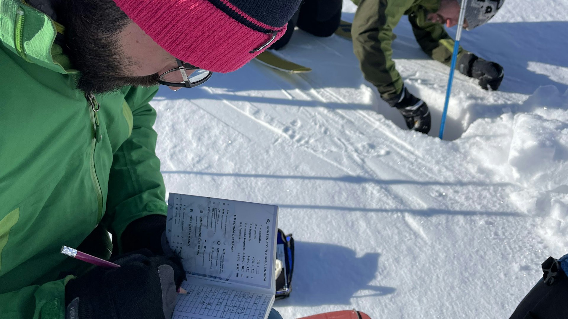 Photo: Maurizio Gretter | Eurac Research
Carlo Marin, remote sensing engineer and test manager, notes the results of the 7 measurements taken at each point. In the background Riccardo Barella measures the temperature in a small hole. The temperature is taken at two different depths 10cm and 30cm and always from the the side not hit by the sun so that the results remain as consistent as possible.
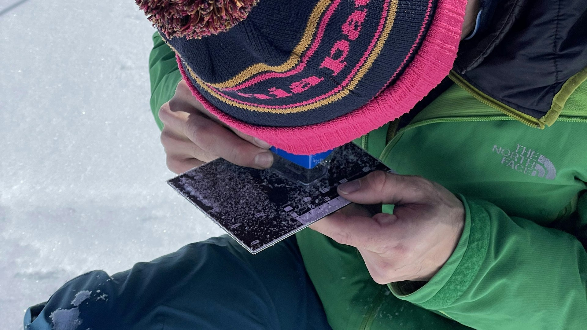 Photo: Maurizio Gretter | Eurac Research
Snow crystals have different shapes depending on the temperature and type of transformation they have undergone since being on the ground.
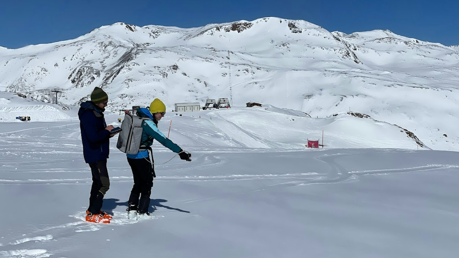 Photo: Maurizio Gretter | Eurac Research
To have additional control, the same spectral technology mounted on the plane was also used on the ground.
In the coming months, the research team will cross-reference the measurement results and test whether the technology is mature enough to be become operational.
“In light of the climate crisis making water an increasingly scarce and valuable commodity, carefully calculating the presence of snow, especially at high altitudes, will become increasingly important in more accurately estimating the availability of water for the summer season and as such, give support to those who have to administer this resource,” concludes Marin.
The partners


The Partners The study is the result of a collaboration between Eurac Research, the University Milano Bicocca and the Italian Space Agency (ASI), with the participation of numerous others, including the Office for Hydrology and Dams of the Autonomous Province of Bolzano, the foresters of Naturno, the Regional Agency for Environmental Protection of the Aosta Valley (ARPA) and CNR IREA, as part of the ASI SCIA Project (Development of Algorithms for the Study of the Cryosphere using PrismA Images). The project has the support of Alpin Arena Senales and the use of the aircraft was provided by CzechGlobe's Brno research center.