


From paintbrushes to pixels
A brief history of Earth observation from Renaissance paintings to stacks of satellite images
In Italy, it is 9 p.m. on 4 October 1957, when, like every evening at the same time, the English-language news broadcast on Radio Moscow begins. The announcement that evening is extraordinary: the first Soviet-made artificial satellite has just been sent into orbit around the Earth. The news dominates the front pages of newspapers around the world for days: “Das planetarische Zeitalter hat begonnen” (The interplanetary era has begun) states the Frankfurter Allgemeine, “U.S. Views Satellite as Russian Victory” adds the Herald Tribune, “Tutto il mondo ascolta la radio della luna artificiale” (The whole world is listening to the artificial moon) the Corriere della Sera goes on to add.
Since then, the so-called “space race” has accelerated unabatedly, and today you have to consult multiple sources to find the exact number of satellites in orbit. According to an ESA report, in March 2025 there were 14,240, of which 11,700 were operational.
There are so many new launches that even ChatGPT can’t keep up when asked what the latest mission was. When asked, the bot’s first answer was, April 2025, Project Kuiper from Cape Canaveral, USA, a United Launch Alliance for Amazon/Kuiper commercial operation.When asked to confirm, and questioning the possibility that something else may have happened anywhere else within the last couple of months, ChatGPT responded, “Good point, there is in fact a more recent mission: ESA, the European Space Agency, sent the Biomass satellite into orbit on April 29 from its base in French Guiana. However, the Kuiper mission I mentioned earlier involves 27 satellites, some of which were launched on 23 June.”
To untangle the data a little, we could start by distinguishing what the satellites are for. The largest and fastest-growing segment is telecommunications, navigation and GPS systems – Elon Musk’s Starlink galaxy alone operates more than 7,000 satellites, more than half of the total in orbit. The least numerous of the missions are the purely scientific ones: those that test new technologies. In between, there are about a thousand satellites for Earth observation, such as ESA’s Biomass satellites which are designed to monitor forests, or the Sentinels of the Copernicus program, which since 2014 have been monitoring our planet for amongst other purposes, to ascertain how much water is available from our snow and ice.
Earth observation before satellites
In his 1505 Codex on the Flight of Birds, Leonardo da Vinci wrote that the view from above is always more complete: “A bird’s motion must always be above the clouds, so that its wings do not get wet and it can discover more countries...”.
Since the Renaissance, there have been numerous paintings of cities and landscapes using bird’s-eye view techniques. Jacopo de' Barbari's view of Venice is a milestone in both art history and Earth observation in Europe. In Asia, a similar technique was used even earlier, for example in the fukinuki yatai perspective paintings: literally meaning “with the roof blown off.”
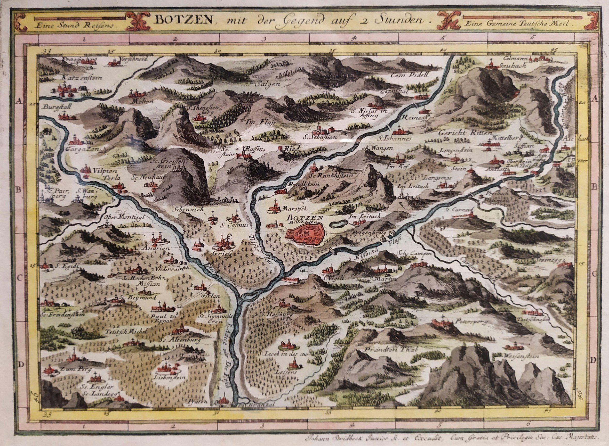
Bird’s eye view of Bolzano and surroundings from the 1700s
Credit: Gabriel Bodenehr | All rights reservedIn 1783, the Mongolfier brothers flew over the French town of Annonay in the hot air balloon they had designed. Hot air balloons are still used today in science to study air quality.
A few decades later, with the advent of photography, whole new possibilities opened up: cameras were mounted on hot air balloons, kites, parachutes and finally airplanes and drones. The first aerial photograph on record is called “Boston, as seen by the eagle and the wild goose” and was taken by J.W. Black in 1860 from a hot air balloon at an altitude of about 630 meters.
Aerial photography became popular throughout the first half of the 20th century and, just as television did not kill the radio, satellites did not replace aerial photos. Even today, aerial flights continue, especially to test new sensors. For example, in 2023, a small Cessna flew over the Senales Valley in two rounds: on board, several sensors based on new experimental technology measured the heat exchange between snow and air.
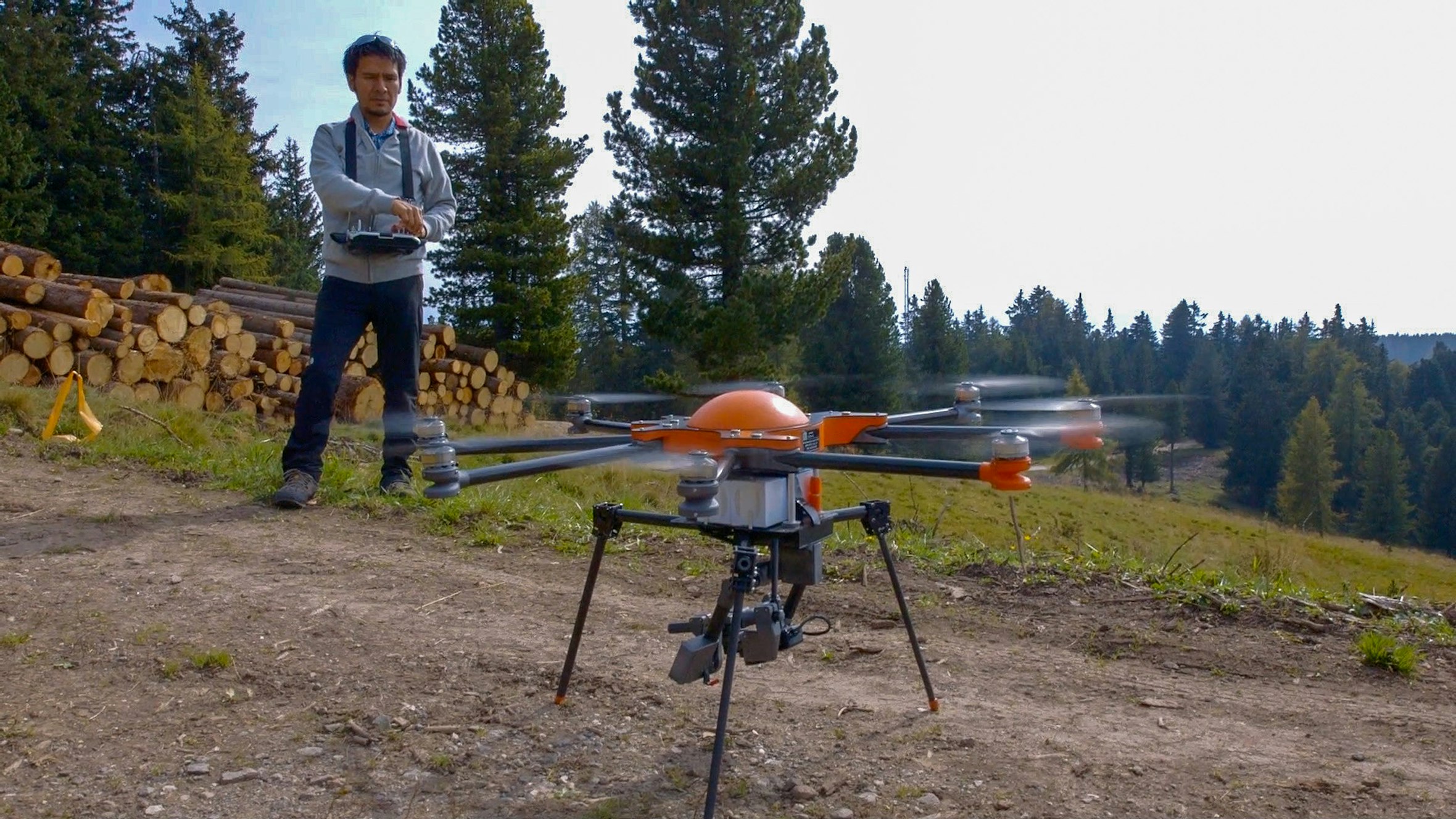
Abraham Mejia-Aguilar launching a drone used in the Monalisa project. This is the first time that Eurac Research has used this tool, together with satellite data and ground measurements. The study, in collaboration with many partners, aims to improve environmental monitoring in the agricultural sector.
Credit: Eurac ResearchFrom declassified military secrets to open scientific missions
Sputnik 1 and all the missions of the 1960s and much of the 1970s proliferated in the context of geopolitical tensions between the Soviet Union and the United States. The American Landsat satellite constellation, for example, although created as a civilian mission, also served to secretly monitor the economic resources of the Soviet Union, in particular their cultivation and storage of grain. This only came to light following the Cold War, when the data was declassified. In the meantime, the main space agencies were established: the European Space Agency in 1975, the Italian Space Agency in 1988, and the German Deutsches Zentrum für Luft- und Raumfahrt in 1997.
In the early 2000s, Terra and Aqua were NASA’s first two “open” missions. For those involved in Earth observation and remote sensing, the revolution was comparable to that of Sputnik: the data from these satellites, derived from the MODIS (Moderate Resolution Imaging Spectroradiometer) sensor, provided information about the entire globe and was made available to everyone, free of charge! To download images from the NASA website, all one had to do was simply register and wait a few days. Those who wanted and were able to process, could receive the data directly as the satellite passed overhead by installing their own antenna – which is exactly what the province of Bolzano has been doing since 2009.
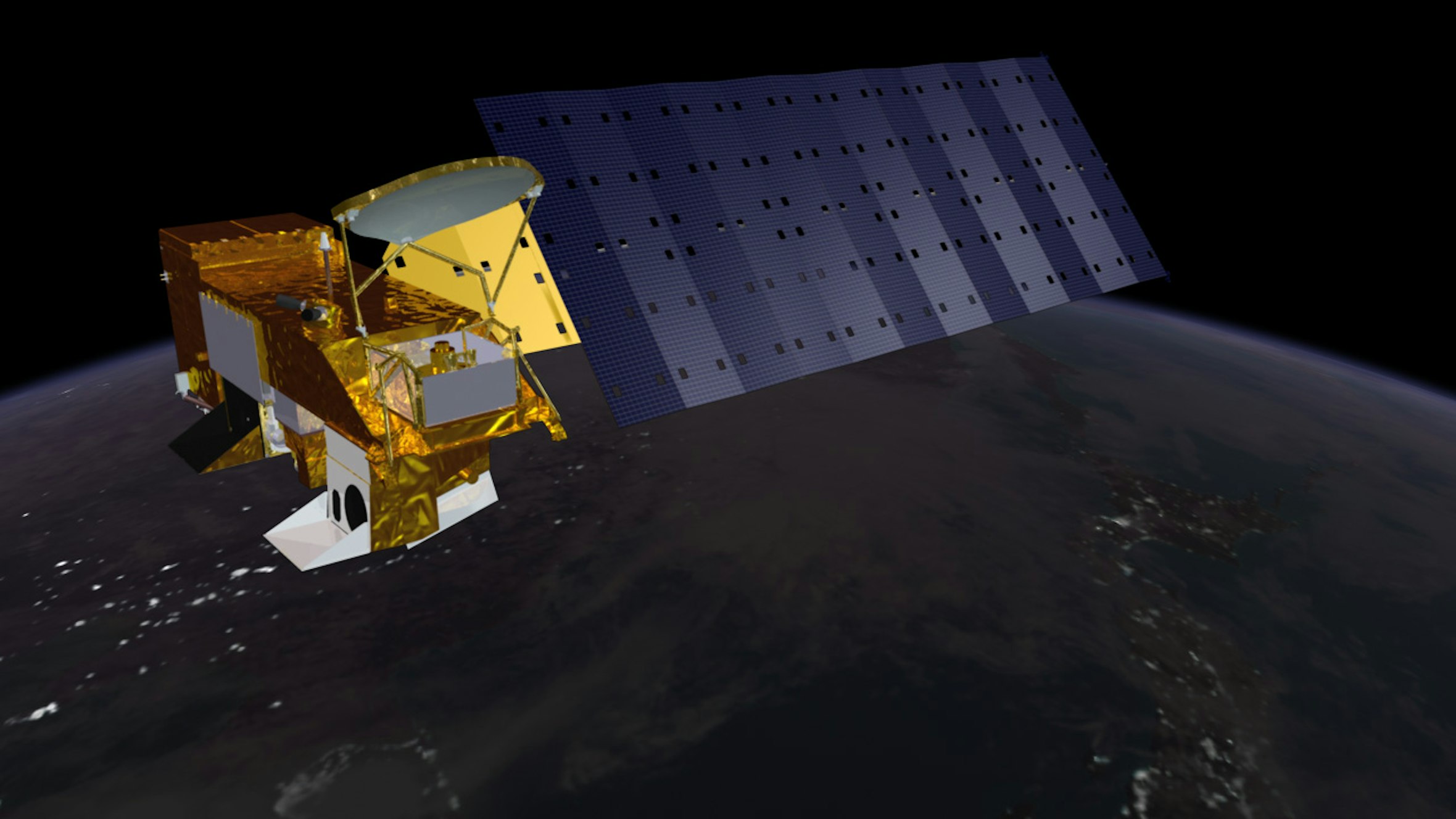
The Aqua satellite, August 2009
Credit: Reto Stöckli | NASA | All rights reservedMODIS is setting a precedent.
The European Copernicus program has launched six types of satellites called Sentinel and plans to launch six more with the expansion of the program by 2030 and in 2013, the Chinese space agency announced its CHEOS program for Earth observation and expects to have about 40 satellites in orbit by the end of this year. The Indian agency, which took its first steps back in the 1980s, has around 40 satellites for monitoring agriculture, water resources, urban planning and rural development, mining, forests, oceanographic resources, and environmental disasters.
At present, most of these missions are for purely civilian purposes and the data is open, although often including a so-called ‘security’ aspect – as in the case of border monitoring. Then there are so-called dual-use systems, such as the Italian COSMO-SkyMed satellites, which operate for both civilian and military purposes. We will probably only learn about technologies with exclusively military purposes when the data is declassified.
Bye Bye Antenna


Not everything is free
For more than a decade now, space has become ever more crowded with private satellites launched by companies offering paid services. These satellites tend to provide very high-resolution images with revisit intervals, passing over the same location daily for instance. Among the leading private companies active in Earth observation are the American Planet Labs Inc. with around 200 satellites, and the Chinese Chang Guang, with over 100 Jilin satellites. These companies often cover niche areas of the sector and charge high prices. For example, the Finnish company ICEYE promotes radar images from its satellites for monitoring oil pipelines. It does not provide standard price lists but estimating a plausible price of around 5-6 euros per square kilometer, one can venture an estimate of the amount that an oil company would have to pay to detect leaks or breaks in pipelines, monitor unauthorized excavations or theft, and verify compliance with all environmental and safety regulations. With coverage of 500-1,000 square kilometers of critical areas – corresponding to approximately 200 linear kilometers – and biweekly monitoring, the cost quickly rises to €50,000 per month. And while it is true that discounts are available on packages, it is also true that intermediary service companies are often needed to interpret the images. And they charge for their services too.
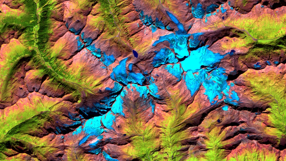
As part of the GLISTT project, in collaboration with the University of Innsbruck and the Civil Protection Department of the Autonomous Province of Bolzano, we have developed a system for monitoring glaciers in South Tyrol and Tyrol that combines traditional field measurements with advanced satellite remote sensing techniques. Here are two images showing the glaciers of the Grossvenediger group. The first is from 22 August 1985 from the Landsat-5 satellite, the second is from 10 September 2023 from the Sentinel-2 satellite. The reduction in glaciers is evident – even in a span of less than 40 years. The images acquired by the two satellites may appear similar in terms of qualityCredit: NASA/Landsat-5 /Processing by Mattia Callegari Credit: ESA/Sentinel-2 /Processing by Mattia Callegari
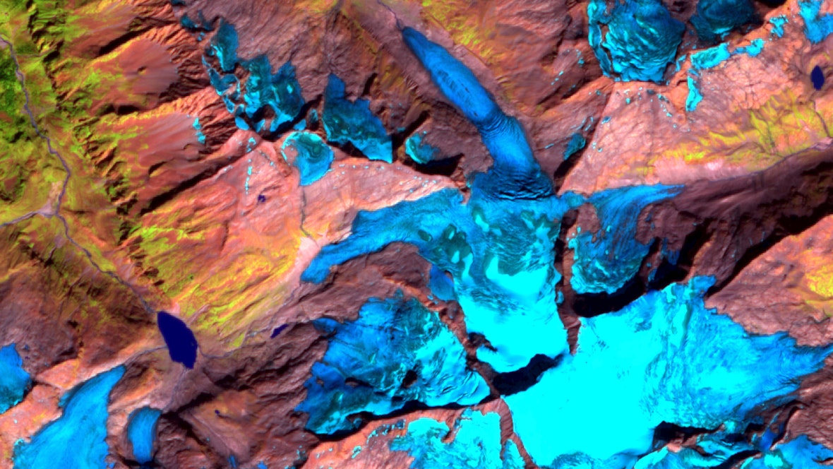
The difference becomes apparent when looking at smaller areas: Sentinel-2 offers significantly higher spatial resolution than Landsat-5, allowing for much more detailed analysis of the territory.Credit: NASA/Landsat-5 /Processing by Mattia Callegari Credit: ESA/Sentinel-2 /Processing by Mattia Callegari
The age of abundance
In the mid-1990s, it was not uncommon to see publications based on the analysis of two or three satellite images. Today, even the simplest study has hundreds, if not thousands, at its disposal. In the early 2000s, a single MODIS image weighed an average of 100-200 megabytes. Today, each Sentinel satellite image is around one to two gigabytes.
Those who handle such large amounts of data can hardly afford to process it locally: the hardware to receive it and the servers to store it are too expensive. Google Earth Engine was the first to offer an alternative: you pay for access to their cloud server, the satellite data remains there, you do your own processing, and you download the results.
There are numerous platforms similar to Google Earth Engine, including those funded by the European Union, which provide centralized access to ESA Copernicus data. OpenEO, launched in 2017, was the first Eurac Research project to help standardize the interface of cloud systems. At present, almost all of our projects rely on these platforms.
For those involved in Earth observation, this is a major new revolution.









 My cookie preferences